Compartir
Glyndwr's Way: British Walking Guide: Planning, Places to Stay, Places to Eat; Includes 58 Large-Scale Walking Maps (en Inglés)
Chris Scott
(Autor)
·
Trailblazer Publications
· Tapa Blanda
Glyndwr's Way: British Walking Guide: Planning, Places to Stay, Places to Eat; Includes 58 Large-Scale Walking Maps (en Inglés) - Scott, Chris
S/ 80,72
S/ 161,44
Ahorras: S/ 80,72
Elige la lista en la que quieres agregar tu producto o crea una nueva lista
✓ Producto agregado correctamente a la lista de deseos.
Ir a Mis Listas
Origen: Reino Unido
(Costos de importación incluídos en el precio)
Se enviará desde nuestra bodega entre el
Lunes 03 de Junio y el
Viernes 14 de Junio.
Lo recibirás en cualquier lugar de Perú entre 2 y 5 días hábiles luego del envío.
Reseña del libro "Glyndwr's Way: British Walking Guide: Planning, Places to Stay, Places to Eat; Includes 58 Large-Scale Walking Maps (en Inglés)"
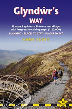
This new title in our British Walking Guides series covers the 135-mile National Trail in Wales following in the footsteps of Owain Glyndŵr, the Welsh prince who led a rebellion against the English in 1400. Traversing a range of open farmland and forest, it links with another National Trail, Offa's Dyke Path, at its start in Knighton and end in Welshpool.10 town plans and 58 large-scale walking maps - at just under 1:20,000 - showing route times, places to stay, points of interest and much morePlus 10 overview mapsItineraries for all walkers - whether walking the route in its entirety over seven to eight days or sampling the highlights on day walks and short breaksPractical information for all budgets - camping, bunkhouses, hostels, B&Bs, pubs and hotels - where to stay, where to eat, what to see, plus detailed street plansComprehensive public transport information - for all access points on the path.Flora and fauna - four page full color flower guide, plus an illustrated section on local wildlifeGreen hiking - understanding the local environment and minimizing our impact on itGPS waypoints. These are also downloadable from the Trailblazer website.Includes extra colour sections: 16pp colour introduction and 10pp of colour mapping for stage sections (one stage per page) with trail profiles.

