Compartir
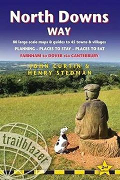
North Downs Way: Farnham to Dover - Includes 80 Large-Scale Walking Maps & Guides to 45 Towns and Villages - Planning, Places to Stay, Places to eat (British Walking Guides) (en Inglés)
John Curtin; Henry Stedman (Autor)
·
Trailblazer Publications
· Tapa Blanda
North Downs Way: Farnham to Dover - Includes 80 Large-Scale Walking Maps & Guides to 45 Towns and Villages - Planning, Places to Stay, Places to eat (British Walking Guides) (en Inglés) - John Curtin; Henry Stedman
S/ 70,91
S/ 141,82
Ahorras: S/ 70,91
Elige la lista en la que quieres agregar tu producto o crea una nueva lista
✓ Producto agregado correctamente a la lista de deseos.
Ir a Mis Listas
Origen: Reino Unido
(Costos de importación incluídos en el precio)
Se enviará desde nuestra bodega entre el
Miércoles 05 de Junio y el
Martes 18 de Junio.
Lo recibirás en cualquier lugar de Perú entre 2 y 5 días hábiles luego del envío.
Reseña del libro "North Downs Way: Farnham to Dover - Includes 80 Large-Scale Walking Maps & Guides to 45 Towns and Villages - Planning, Places to Stay, Places to eat (British Walking Guides) (en Inglés)"
A 131-mile National Trail, the North Downs Way runs from Farnham in Surrey to Dover in Kent, partly following the old Pilgrims' Way to the shrine of St Thomas à Becket at Canterbury. It winds its way through the protected landscape of the Surrey Hills and the Kent Downs, passing medieval churches, castles, Neolithic burial sites, vineyards and numerous WWII defences. There are literary associations with Swift, Cobbett, Dickens and Jane Austen.The guide includes:1. Unique mapping features – In many walking guides the reader has to read a route description then try to relate it to the map. Our guides are easier to use because walking directions, tricky junctions, places to stay and eat, points of interest and walking times are all written onto the maps themselves in the places to which they apply. With their uncluttered clarity, these are not general-purpose maps but fully-edited maps drawn by walkers for walkers. Downloadable GPS waypoints also included.2. The largest scale walking maps available – At just under 1:20,000 (8cm or 31/8 inches to 1 mile) our maps are bigger than even the most detailed walking maps currently available in the shops.3. An all-in-one guide – Trailblazer guides include practical information not usually found in walking guides to the UK: reviews of places to stay, places to eat, attractions along the way and detailed public transport information showing all access points on the path, for weekend and day walkers.

